Agricultural Technology Department Organizes a General Lecture
by Riszqie Naskiah Naim 1 tahun yang lalu 0 comments 466 views
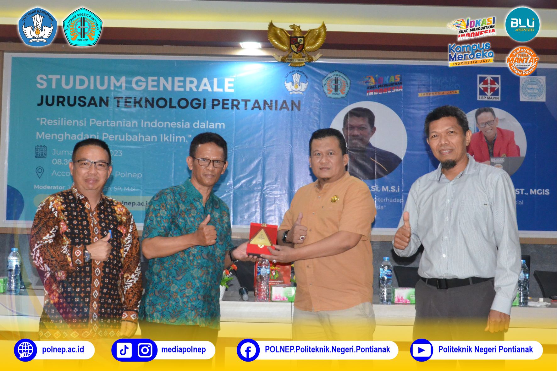
Agricultural Technology Department of Pontianak State Polytechnic (Polnep) organized a general lecture on Friday (21/07). The theme of the lecture is “The Resilience of Indonesian Agriculture in Facing Climate Change†and featuring Dr. Andi Ihwan, S.Si., M.Si. as Dr. Eng. Ilham Alimuddin, ST., MGIS. as speakers. Acted as the moderator of the event was Jaini Fakhrudin, SP., M.Si. The general lecture was held off-line at Accounting Hall and officially opened by Director of Polnep Dr. H. Widodo PS, S.T., M.T. The participants were lecturers and students, in fact, some of them attended the event online.
One of the speakers in the general lecture was Dr. Andi Ihwan. He is a lecturer of MIPA Faculty, Universitas Tanjungpura and an expert in the field of hydrometeorology. He lectured on the impact of El Nino phenomenon to drought in Indonesia. El Nino is believed to bring significant impact on agriculture in Indonesia. One possible impact is causing drought that can be seen from the declining of rain intensity in some areas of Indonesia.
The second speaker in the general lecture was Dr. Ilham Alimuddin. He is a lecturer of Geology Engineering Department of Universitas Hasanuddin (UNHAS) Makassar. Currently, he holds position of Vice Chairman of Indonesian Society for Remote Sensing (MAPIN) and the Head of Center for Disaster Studies, Research and Community Service Body (LPPM) UNHAS. The material presented was about the use of geospatial data in agriculture. Some of the benefits of Geographic Information System (GIS) application include disaster, environmental and spatial information. The use of GIS can anticipate various disasters such as floods, droughts, extreme weather, tsunamis, extreme waves and abrasion. Remote sensing-based information in the plantation sector is used for oil palm land clearing, oil palm growth monitoring, agricultural land distribution calculation, plantation and forest imaging. The benefits of GIS in the agricultural sector include monitoring agricultural crops, controlling pests and diseases, determining water resources, monitoring agricultural production, identifying land damage, assessing the risk of agricultural enterprises, and assisting in determining the harvest period.
(Translated by: Riszqie Naskiah Na’im)
Tags: No Tags
0 Comments
Leave a Comment
Recent Posts
-

KUATKAN NILAI KEAGAMAAN DAN KEPEDULIAN SOSIAL, POLNEP GELAR SALAT ID DAN KURBAN BERSAMA
06/06/2025
Pontianak, Humas Polnep - Politeknik Negeri Pontianak (Polnep) menggelar salat Iduladha 1446 Hijriah......
-
WUJUD KOMITMEN DALAM TRANSPARANSI DAN PENINGKATAN MUTU PENDIDIKAN VOKASI, POLNEP GELAR EVALUASI KINERJA BLU 2024
04/06/2025
Pontianak, Humas Polnep - Politeknik Negeri Pontianak (Polnep) gelar kegiatan Evaluasi Kinerja Satua......
-
KISAH INSPIRATIF : PERJALANAN PRADHITA SELFIRA MENGUKIR MIMPI DARI POLNEP KE PEMPROV KALBAR
03/06/2025
Pontianak, Humas Polnep - Berawal dari Kota Pontianak, tempat mentari menari tepat di atas ubun-ubun......